The Karakoram Ranges are a 500 km mountain system in Pakistan, China and India, home to K2 (8,611 m) and four of the world’s 8,000 m peaks.
Lying just north of the Himalaya, the range holds more glacier ice than anywhere outside the polar regions, and some of the greatest trekking and climbing on Earth.
ByRozi Ali, founder of Discover Karakoram and a mountain guide from Hushe with about 40 years in these mountains. Updated 23 October 2026.
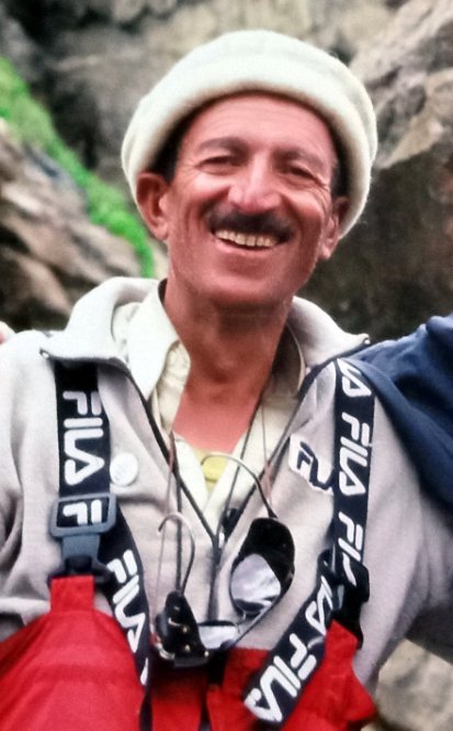
Rozi Ali was born in Hushe in 1959 and has worked in the Karakoram for about 40 years, as a porter, high altitude guide and expedition leader. He guided the 1988 Italian first ascent of Masherbrum II and founded Discover Karakoram, a government licensed operator (DTS No. 2369).Read more about Rozi Ali.
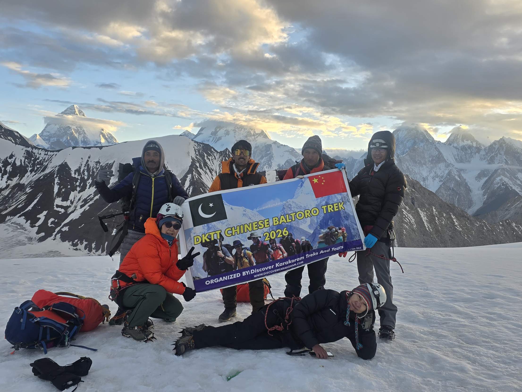
I was born in Hushe, a village at the foot of Masherbrum, and I have spent my life working in the Karakoram, from carrying loads as a young porter to guiding the 1988 first ascent of Masherbrum II. This guide brings together the facts you find in encyclopedias with what our team sees on the ground every season: where the mountains are, the highest peaks, the glaciers, the Karakoram Highway, the best time to come, and how to see K2 with your own eyes.
Karakoram Ranges at a glance
The Karakoram is a separate mountain range north of the Himalaya, about 500 km long, running from the far north east of Afghanistan to the edge of Ladakh. Most of it lies in Gilgit-Baltistan, Pakistan, with its northern side in Xinjiang, China, and its eastern end in Ladakh. Its highest point is K2 (8,611 m).
Karakoram Ranges in numbers
- About 500 kmLength of the range, north west to south east
- K2, 8,611 mHighest point, second highest mountain on Earth
- 4 peaks over 8,000 mK2, Gasherbrum I, Broad Peak, Gasherbrum II
- Pakistan, China, IndiaPlus the far north west tip in Afghanistan and Tajikistan
- Siachen Glacier, 76 kmLongest glacier outside the polar regions
- 28 to 50 percentShare of the range covered by glaciers (estimates differ)
- Khunjerab Pass, 4,693 mHighest paved international border crossing
- “Black gravel”Meaning of the Turkic name Karakoram
Figures: Wikipedia (Karakoram; List of highest mountains on Earth) and Britannica. Checked 23 October 2026.
Where are the Karakoram Ranges? (map)
The Karakoram lies on the great watershed between South Asia and Central Asia. To the south, the Indus and Shyok rivers separate it from the Himalaya. To the north, the Shaksgam and Yarkand river valleys separate it from the Kunlun and the Tarim basin. To the west it meets the Hindu Kush and the Pamir.
Interactive map: click a marker for details. Locations are approximate. Map data © OpenStreetMap contributors, SRTM; style © OpenTopoMap (CC BY-SA).
Countries and regions
- Pakistan: Gilgit-Baltistan holds most of the range, including K2, the Baltoro, Hunza, Nagar, Shigar, Hushe and Skardu.
- China: the northern slopes in Xinjiang, including the Shaksgam valley and the north side of K2.
- India: the eastern Karakoram in Ladakh, including the Saser and Rimo groups.
- Afghanistan and Tajikistan: the far north western tip of the range.
Boundaries of the range
The Indus and the Shyok mark the southern edge, the Shaksgam and Yarkand rivers the northern edge, and the Ishkuman and Karambar valleys the western edge near the Hindu Kush. In the east, the range ends near the Karakoram Pass and the Chang Chenmo.
Karakoram, Himalaya and Hindu Kush: where three ranges meet
The Karakoram is often described as part of the Himalaya, but geographers treat it as a separate range. On the Karakoram Highway near Jaglot, north of Chilas, a viewpoint marks the place where the three great ranges meet: the Himalaya to the south (with Nanga Parbat), the Hindu Kush to the west and the Karakoram to the north. The Indus and Gilgit rivers join close by.
What does “Karakoram” mean?
Karakoram is a Turkic name meaning “black gravel”. Central Asian traders first used it for the Karakoram Pass, on the old caravan route between Ladakh and Yarkand, and European travellers later used it for the whole range west of the pass. You will also see the spelling “Karakorum”.
The subranges of the Karakoram
The Karakoram is made of many groups called Muztagh, a Turkic word for “ice mountain”. The main ones on the Pakistan side are:
Baltoro Muztagh
The heart of the range, around the Baltoro Glacier: K2, Broad Peak, the Gasherbrums, the Trango Towers and Muztagh Tower. OurK2 Base Camp and Gondogoro La trek and our8,000 m expeditions all run here.
Masherbrum Mountains
South of the Baltoro, above the Hushe valley: Masherbrum (K1, 7,821 m), Chogolisa, K6, K7, Link Sar and Laila Peak. This is our home area. SeeLaila Peak,Humbroq Peak and theK7 Base Camp trek.
Panmah Muztagh
North of the Biafo Glacier: the Latok peaks and Baintha Brakk (the Ogre), some of the hardest mountains on Earth. Seethe Ogre.
Hispar Muztagh
North of the Hispar Glacier: Distaghil Sar (7,884 m), Khunyang Chhish and Kanjut Sar. The Biafo and Hispar glaciers together form one of the longest glacier routes outside the poles, via Snow Lake and Hispar La.
Batura Muztagh
The north western wall above Hunza and Gojal: Batura Sar (7,795 m), Shispare and Muchu Chhish. See ourMuchu Chhish expedition.
Rakaposhi-Haramosh Mountains
South of the Hunza and Nagar valleys: Rakaposhi (7,788 m), Diran, Spantik, Malubiting and Haramosh. SeeRakaposhi andSpantik.
Saltoro, Siachen, Rimo and Saser Muztagh
The eastern Karakoram, around the Siachen Glacier and in Ladakh. Much of this area is closed to visitors because of its military situation.
Highest peaks in the Karakoram
The highest peaks in the Karakoram are K2 (8,611 m), Gasherbrum I (8,080 m), Broad Peak (8,051 m) and Gasherbrum II (8,035 m), all in the Baltoro Muztagh. Dozens more summits rise above 7,000 m. The table below lists the 20 highest, with the ways to see or climb them.
| Rank | Peak | Height (m) | Height (ft) | Subrange (Muztagh) | First ascent | How to see it |
|---|---|---|---|---|---|---|
| 1 | K2 | 8,611 | 28,251 | Baltoro | 1954 | K2 expedition,K2 Base Camp trek |
| 2 | Gasherbrum I (Hidden Peak) | 8,080 | 26,510 | Baltoro | 1958 | Expedition |
| 3 | Broad Peak | 8,051 | 26,414 | Baltoro | 1957 | Expedition, seen from Concordia |
| 4 | Gasherbrum II | 8,035 | 26,362 | Baltoro | 1956 | Expedition |
| 5 | Gasherbrum III | 7,946 | 26,070 | Baltoro | 1975 | Seen on the K2 Base Camp trek |
| 6 | Gasherbrum IV | 7,932 | 26,024 | Baltoro | 1958 | Expedition, seen from Concordia |
| 7 | Distaghil Sar | 7,884 | 25,866 | Hispar | 1960 | Hispar and Shimshal area |
| 8 | Khunyang Chhish | 7,823 | 25,666 | Hispar | 1971 | Hispar Glacier area |
| 9 | Masherbrum (K1) | 7,821 | 25,659 | Masherbrum | 1960 | Expedition,Base Camp trek |
| 10 | Batura Sar | 7,795 | 25,574 | Batura | 1976 | Seen from upper Hunza |
| 11 | Rakaposhi | 7,788 | 25,551 | Rakaposhi-Haramosh | 1958 | Expedition, seen from the Karakoram Highway |
| 12 | Kanjut Sar | 7,760 | 25,460 | Hispar | 1959 | Hispar area |
| 13 | Saltoro Kangri | 7,742 | 25,400 | Saltoro | 1962 | Restricted area |
| 14 | Saser Kangri I | 7,672 | 25,171 | Saser | 1973 | Ladakh side |
| 15 | Chogolisa | 7,665 | 25,148 | Masherbrum | 1975 | Expedition, seen from Gondogoro La |
| 16 | Shispare | 7,611 | 24,970 | Batura | 1974 | Seen from Passu and Hunza |
| 17 | Trivor | 7,577 | 24,859 | Hispar | 1960 | Nagar side |
| 18 | Skyang Kangri | 7,545 | 24,754 | Baltoro | 1976 | Near K2 |
| 19 | Mamostong Kangri | 7,516 | 24,659 | Rimo | 1984 | Ladakh side |
| 20 | Saser Kangri II E | 7,513 | 24,649 | Saser | 2011 | Ladakh side |
Tap a column heading to sort. Heights and first ascent years: Wikipedia, List of highest mountains on Earth (checked 23 October 2026).
The four 8,000 m peaks
All four 8,000 m peaks of the Karakoram stand within about 20 km of Concordia, the junction of the Baltoro and Godwin Austen glaciers. No other place on Earth has four 8,000 m summits so close together. K2 and Broad Peak face each other across the Godwin Austen Glacier, while Gasherbrum I and II share a Base Camp at the head of the Baltoro. Gasherbrum II is widely seen as one of the best first 8,000 m peaks. Read ourGasherbrum II guide.
Famous 7,000 m and 6,000 m peaks
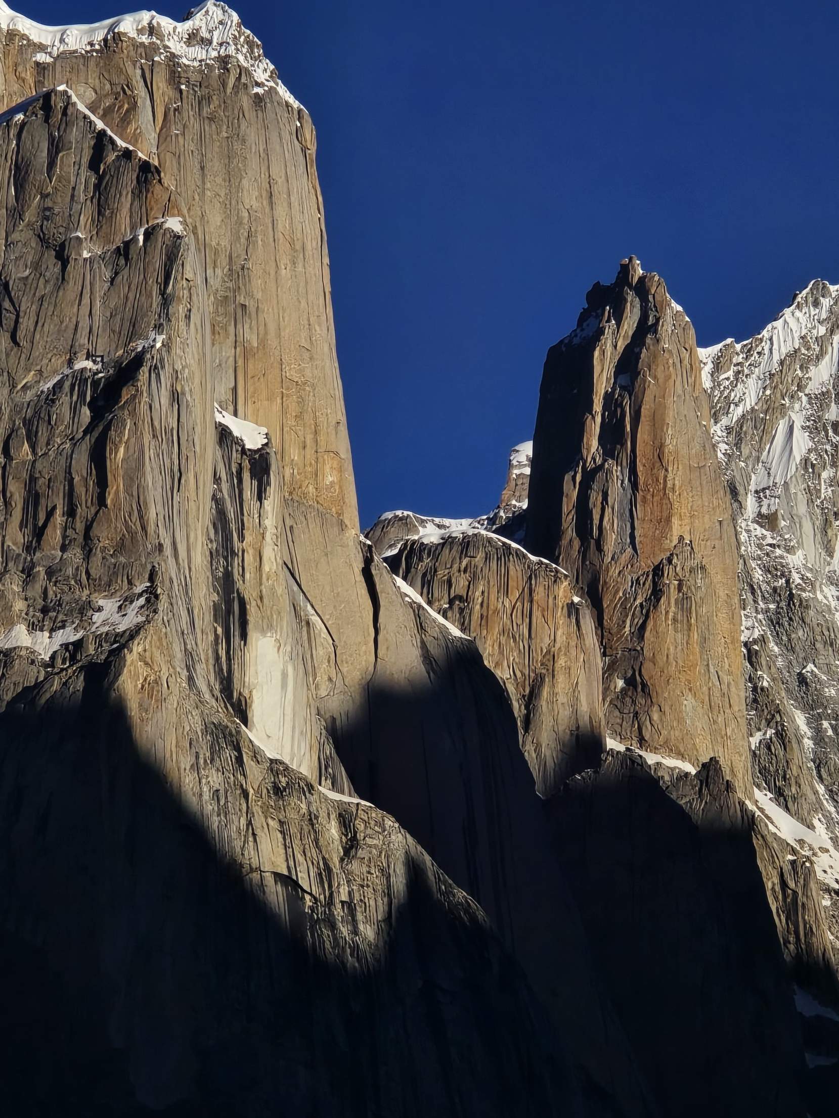
Below the giants are hundreds of beautiful and challenging peaks. Masherbrum was the first Karakoram peak to be surveyed, as K1. Rakaposhi rises almost 6,000 m above the Hunza river. Spantik (7,027 m) is a classic first 7,000 m peak. Laila Peak (6,096 m) is one of the most photographed mountains in Pakistan, and the Trango Towers hold some of the biggest granite walls on Earth.
K2, the king of the Karakoram
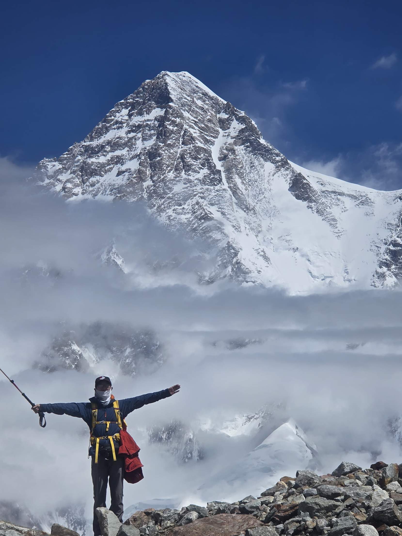
K2 is the second highest mountain on Earth at 8,611 m (28,251 ft). It stands on the border between Gilgit-Baltistan, Pakistan, and Xinjiang, China, at the head of the Godwin Austen Glacier. It was first climbed on 31 July 1954 by Achille Compagnoni and Lino Lacedelli of an Italian expedition, and first climbed in winter on 16 January 2021 by a team of Nepali climbers.
K2 facts
| Fact | Detail |
|---|---|
| Height | 8,611 m (28,251 ft) |
| Location | Pakistan and China border, Baltoro Muztagh |
| Name | Survey name from 1856: the second peak listed in the Karakoram (K2) |
| First ascent | 31 July 1954, Achille Compagnoni and Lino Lacedelli |
| First winter ascent | 16 January 2021, a team of Nepali climbers |
| Normal route | Abruzzi Spur (south east ridge) from the Pakistan side |
| Base Camp | About 5,000 m on the Godwin Austen Glacier |
Why K2 is harder than Everest
K2 is steeper on every side, its normal route has technical sections such as House’s Chimney, the Black Pyramid and the Bottleneck, it is further from help, and its weather is more unstable. Its record of deaths for each summit has long been far higher than Everest’s, which is why climbers call it the Savage Mountain. Read ourK2 Abruzzi Spur guide.
Three ways to see K2 with your own eyes
1.The K2 Base Camp trek (19 days). Walk the Baltoro Glacier to Concordia and K2 Base Camp, then cross Gondogoro La to Hushe. See thetrip page and theday by day itinerary.
2.The Barah Broq and Moses Peak trek (7 days). The shortest way to see K2: a non technical summit of about 5,350 m near Khaplu with a view of K2 and the Gasherbrums. See theBarah Broq trek.
3.The K2 expedition (55 days). For experienced 8,000 m climbers. See theK2 expedition.
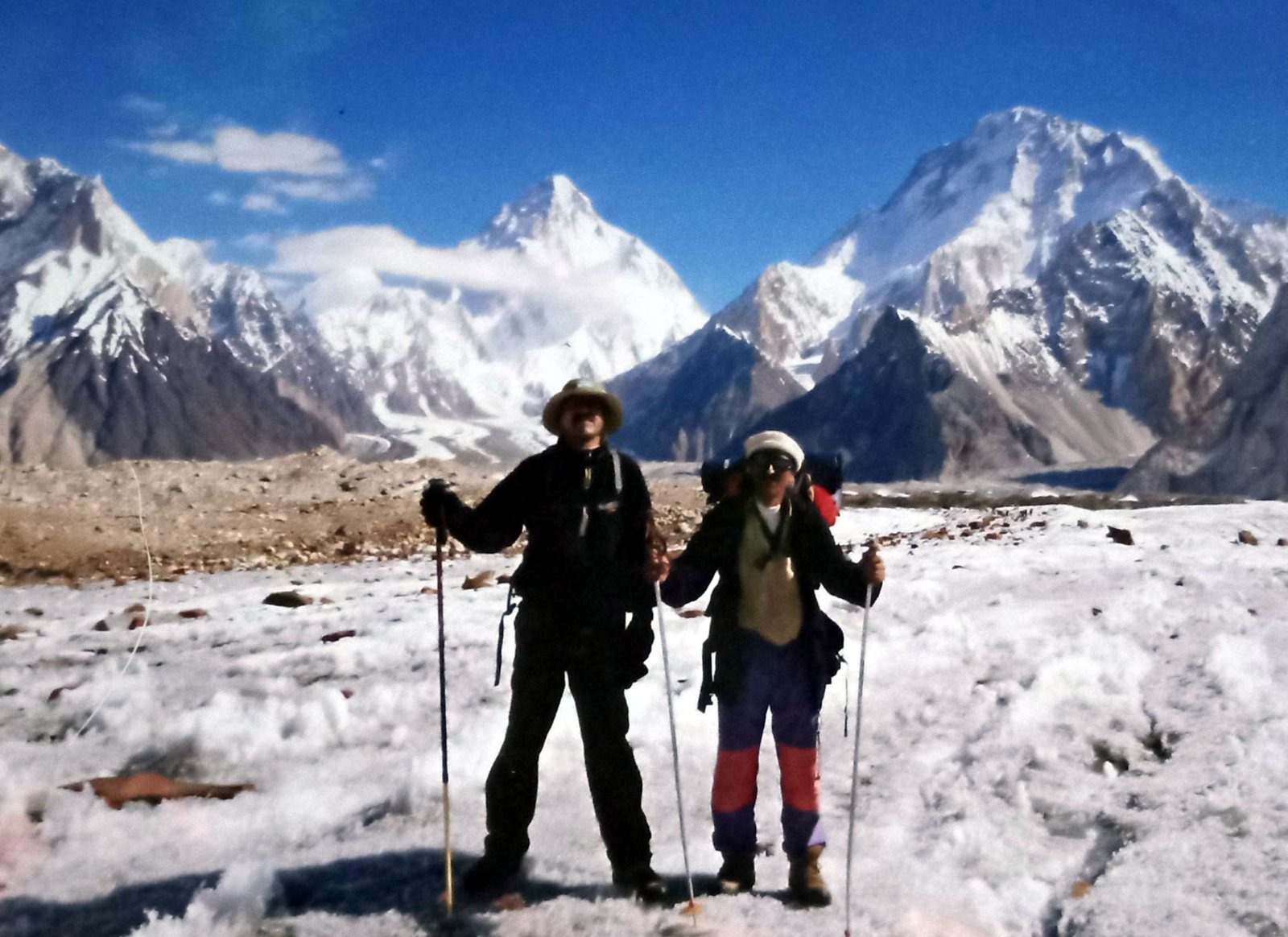
Glaciers of the Karakoram
The Karakoram is the most heavily glaciated mountain range outside the polar regions. Estimates of its glacier cover range from about 28 to 50 percent, over 15,000 km², depending on how the range and the glaciers are measured. Its longest glaciers are among the longest anywhere outside the poles.
| Glacier | Length | Where |
|---|---|---|
| Siachen | 76 km | Eastern Karakoram |
| Biafo | 63 km | Panmah and Hispar Muztagh, from Askole to Snow Lake |
| Baltoro | About 57 to 63 km (sources differ) | Baltoro Muztagh, from Paiju to Concordia and beyond |
| Batura | About 57 km | Batura Muztagh, above Passu |
| Hispar | About 49 km | Hispar Muztagh, from Hispar La to Nagar |
The Karakoram anomaly explained
In most of the world’s mountains, glaciers are shrinking fast. In the central and western Karakoram many glaciers have been stable or have even gained a little mass in recent decades, while glaciers in the eastern Karakoram and the Himalaya retreat. Scientists call this the Karakoram anomaly. Possible reasons include more winter snowfall from westerly weather systems, cooler summers, and thick layers of rock debris that insulate many Karakoram glaciers. Several Karakoram glaciers also surge, advancing quickly for a few years before slowing down again.
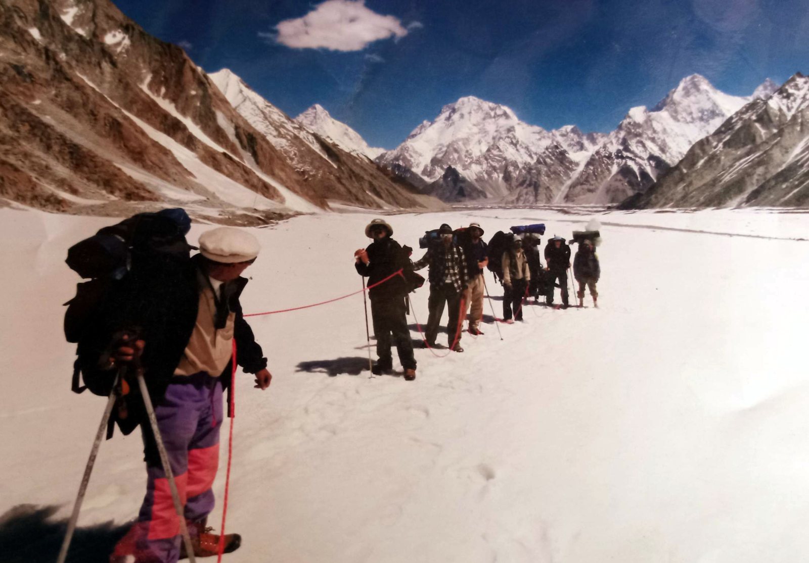
Geology: how the Karakoram was formed
The Karakoram rose as the Indian plate pushed north into the Eurasian plate, a collision that began about 50 million years ago and still continues. The range lies along the boundary of these plates, one of the most geologically active zones on Earth, crossed by major faults such as the Karakoram Fault. Granite bodies pushed up from deep in the crust form the huge walls of the Trango Towers, the Charakusa valley and the Nangma valley, while the summits of K2 and Broad Peak are made of very old metamorphic and granitic rock. Earthquakes and landslides are part of life here: Attabad Lake in Hunza was formed by a landslide in 2010.
Passes of the Karakoram
Khunjerab Pass (4,693 m)
The highest paved international border crossing in the world, on the Karakoram Highway between Pakistan and China. It is the only pass across the range open to motor traffic, usually from about May to November.
Karakoram Pass (5,540 m)
The old caravan pass between Ladakh and Yarkand that gave the range its name. It lies in a restricted area at the eastern end of the range and is no longer used as a trade route.
Trekking passes
- Gondogoro La (5,585 m), between Concordia and the Hushe valley, the most famous trekking pass in Pakistan
- Hispar La (about 5,150 m), linking the Biafo and Hispar glaciers via Snow Lake
- Thalle La (about 4,600 m), a short, non technical pass between the Hushe and Shigar valleys
- Shimshal Pass, used by herders of Shimshal in Gojal
Karakoram Highway travel guide
The Karakoram Highway (KKH) runs about 1,300 km from Hasan Abdal near Islamabad to Kashgar in China, crossing the Karakoram at the Khunjerab Pass (4,693 m). It was completed in 1979 and opened to the public in 1986, and it follows one of the old routes of the Silk Road. About 800 km of it lies in Pakistan.
Karakoram Highway stage by stage (Pakistan side)
| Stage | Highlights | Typical overnight |
|---|---|---|
| Islamabad to Besham | Taxila, the Hazara hills, first view of the Indus | Besham |
| Besham to Chilas | The Indus gorge, Shatial and Chilas rock carvings | Chilas |
| Chilas to Gilgit | Nanga Parbat viewpoint, the meeting point of three ranges | Gilgit |
| Gilgit to Karimabad (Hunza) | Rakaposhi viewpoint, Baltit and Altit forts | Karimabad |
| Karimabad to Passu | Attabad Lake, Passu Cones, Hussaini bridge | Passu or Gulmit |
| Passu to Khunjerab and back | Sost, Khunjerab National Park, the China border | Sost or Passu |
Driving times change with roadworks, landslides and weather. Most people take two days from Islamabad to Gilgit by road, or fly from Islamabad to Gilgit or Skardu in about an hour when the weather allows.
Best time, border season and safety
The KKH in Hunza is good from April to October, with blossom in April and autumn colours in late October. The Khunjerab Pass and the China border are usually open from about May to November. Road blocks from landslides are common after heavy rain, so always keep a spare day. Gilgit-Baltistan is known for its friendly people, and we keep our guests updated on road conditions every day. Explore ourKarakoram Highway tour, theSilk Road tour to Kashgar, theKKH cycling tour, or read ourKarakoram Highway guide.
People and culture of the Karakoram
The valleys of the Karakoram are home to many peoples with their own languages: Balti in Baltistan, Burushaski in Hunza and Nagar, Wakhi in Gojal and Shimshal, and Shina around Gilgit. Many villages farm apricots, barley, wheat and potatoes on terraces watered by glacier channels, and keep yaks, sheep and goats in high summer pastures. Old forts and palaces such as Baltit, Altit, Shigar and Khaplu tell the story of the small kingdoms that ruled these valleys until the 1970s. Polo is the traditional sport, played freestyle at the famousShandur Polo Festival.
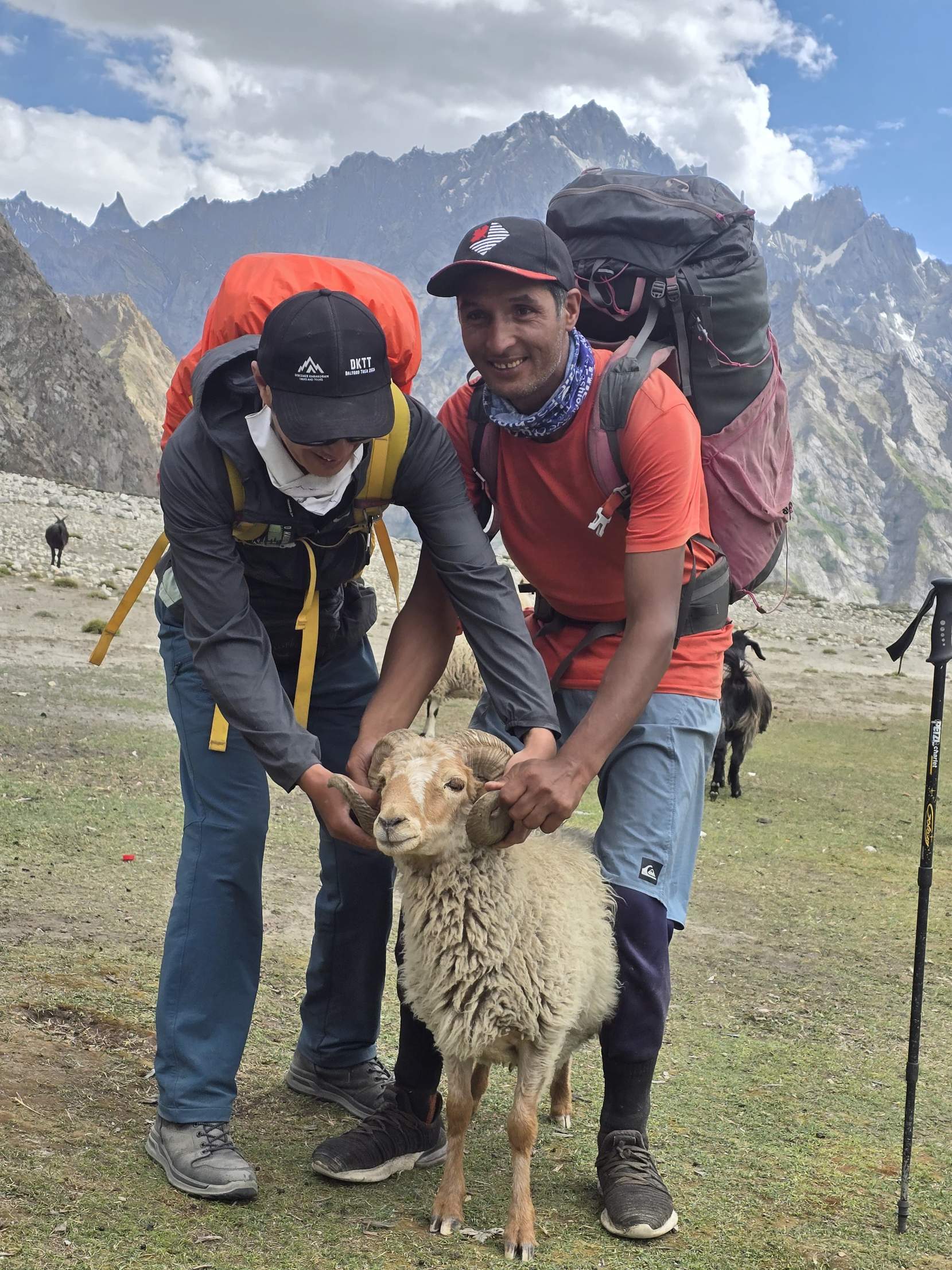
The high altitude porters and guides of Baltistan, many of them from Hushe, Shimshal and the Shigar valley, carry the loads and fix the ropes on almost every expedition. Their skill is the foundation of Karakoram mountaineering.
Wildlife and national parks
The Karakoram is home to the snow leopard, Himalayan ibex, markhor, Marco Polo sheep, Himalayan brown bear, golden marmot, lammergeier and golden eagle. Two large protected areas cover much of the range in Pakistan: Central Karakoram National Park around the Baltoro, Biafo and Hispar glaciers, and Khunjerab National Park on the China border. In winter, snow pushes snow leopards and ibex down towards the villages of the Hushe valley, where a family of snow leopards has been seen in every season for the last three years. See oursnow leopard expedition,Himalayan ibex andmarkhor pages, or read thesnow leopard tracking guide.
Exploration and climbing history
| Year | Event |
|---|---|
| 1856 | Thomas Montgomerie of the Great Trigonometrical Survey lists the Karakoram peaks as K1 to K32; K1 is Masherbrum and K2 keeps its survey name |
| 1892 | Martin Conway explores the Baltoro and names Broad Peak, Hidden Peak and Bride Peak (Chogolisa) |
| 1909 | The Duke of the Abruzzi attempts K2 by the ridge now called the Abruzzi Spur |
| 1954 | First ascent of K2 by an Italian expedition |
| 1956 to 1960 | First ascents of Gasherbrum II, Broad Peak, Gasherbrum I, Gasherbrum IV, Rakaposhi and Masherbrum |
| 1977 | First ascent of Baintha Brakk (the Ogre) by Doug Scott and Chris Bonington |
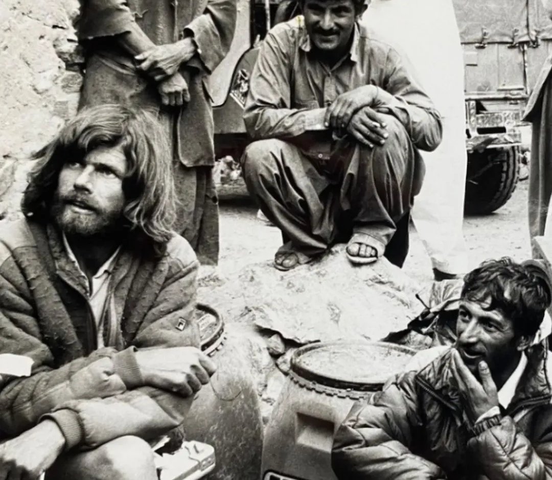
| 1979 | Reinhold Messner’s K2 expedition; Messner and Michl Dacher summit by the Abruzzi Spur, with our founder Rozi Ali on the team |
| 1988 | Italian first ascent of Masherbrum II in the Hushe valley, guided by our founder Rozi Ali |
| 2021 | First winter ascent of K2 by a team of Nepali climbers |
| 2023 | First ascent of Yernamandu Kangri, organised by Discover Karakoram |
| 2024 | First ascent of Muchu Chhish (7,453 m), once the highest unclimbed peak in the world |
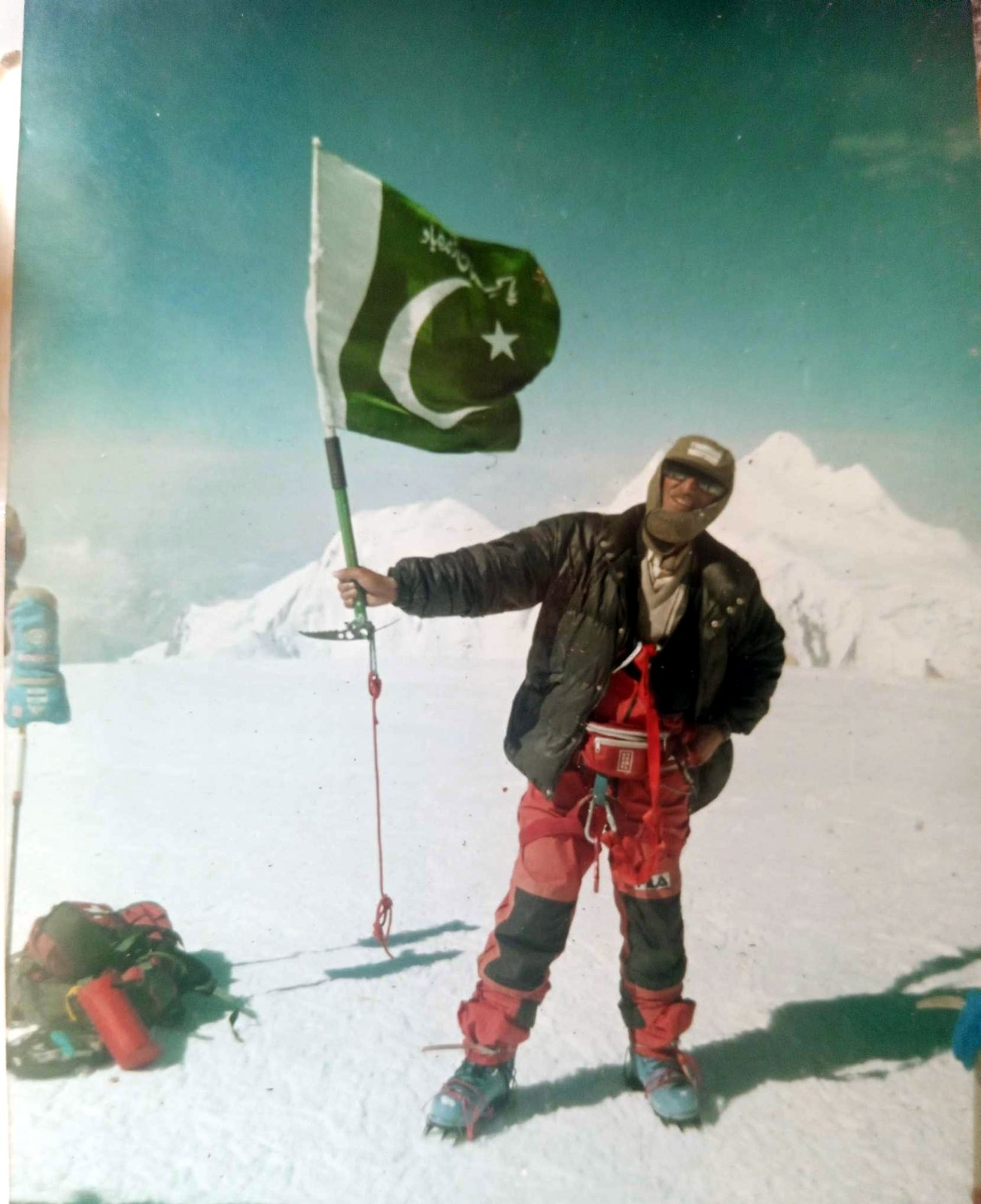
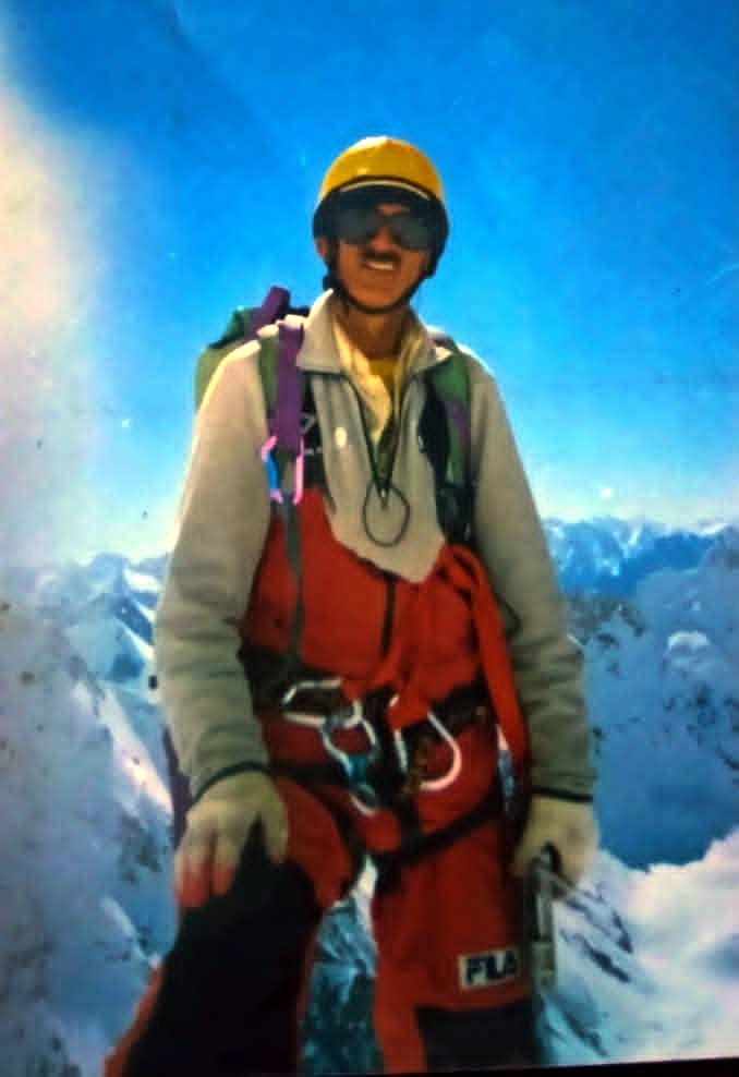
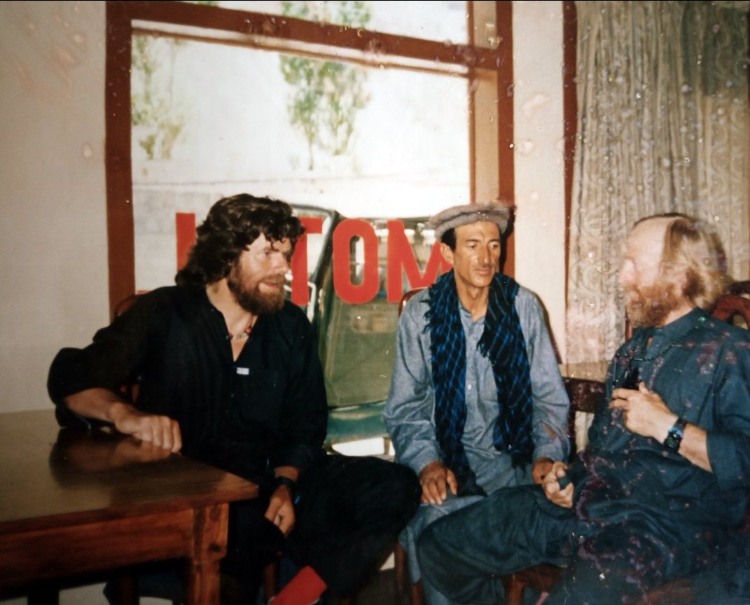
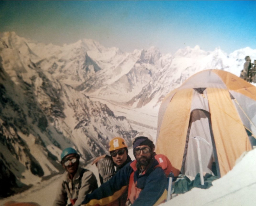
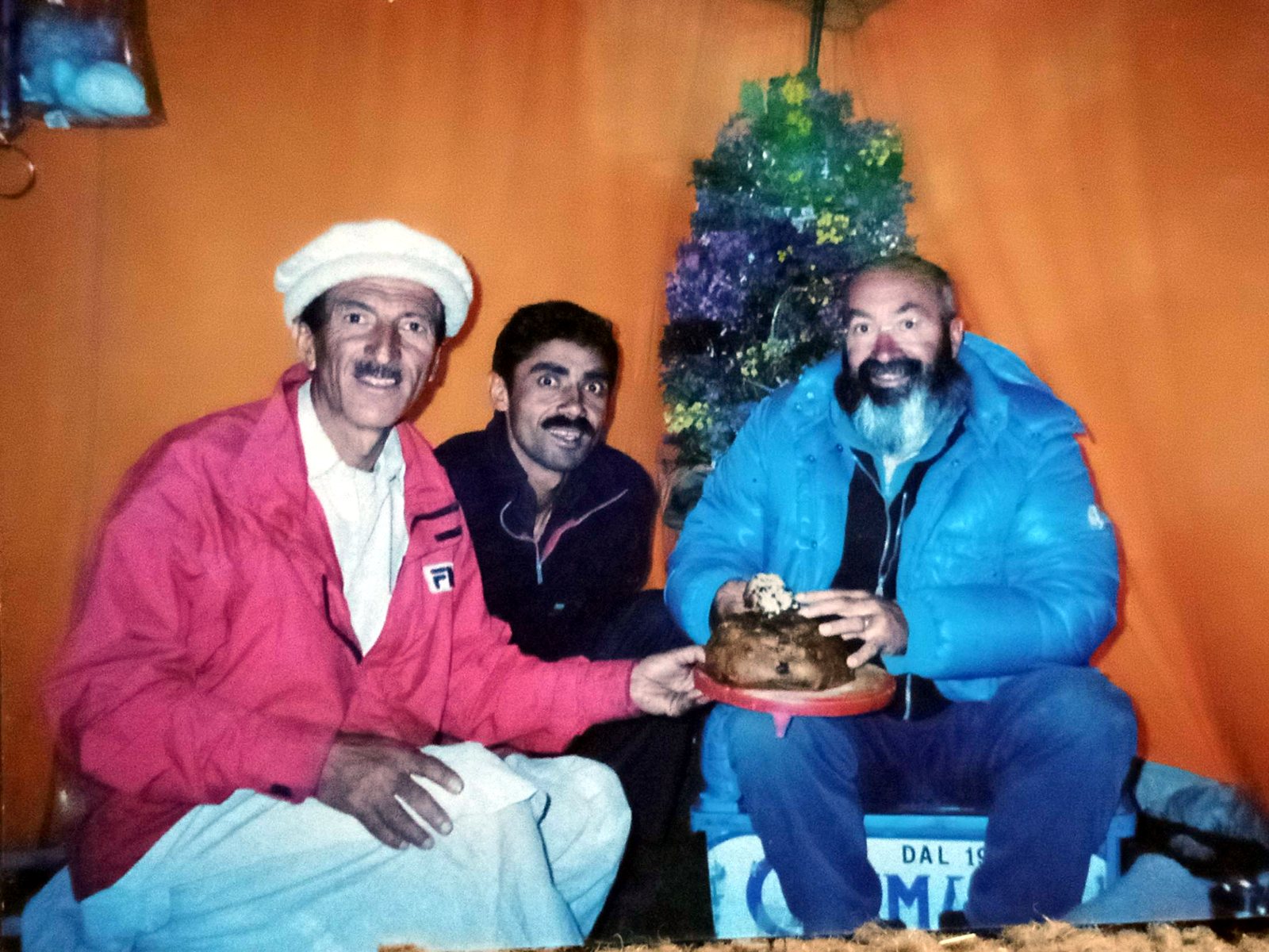
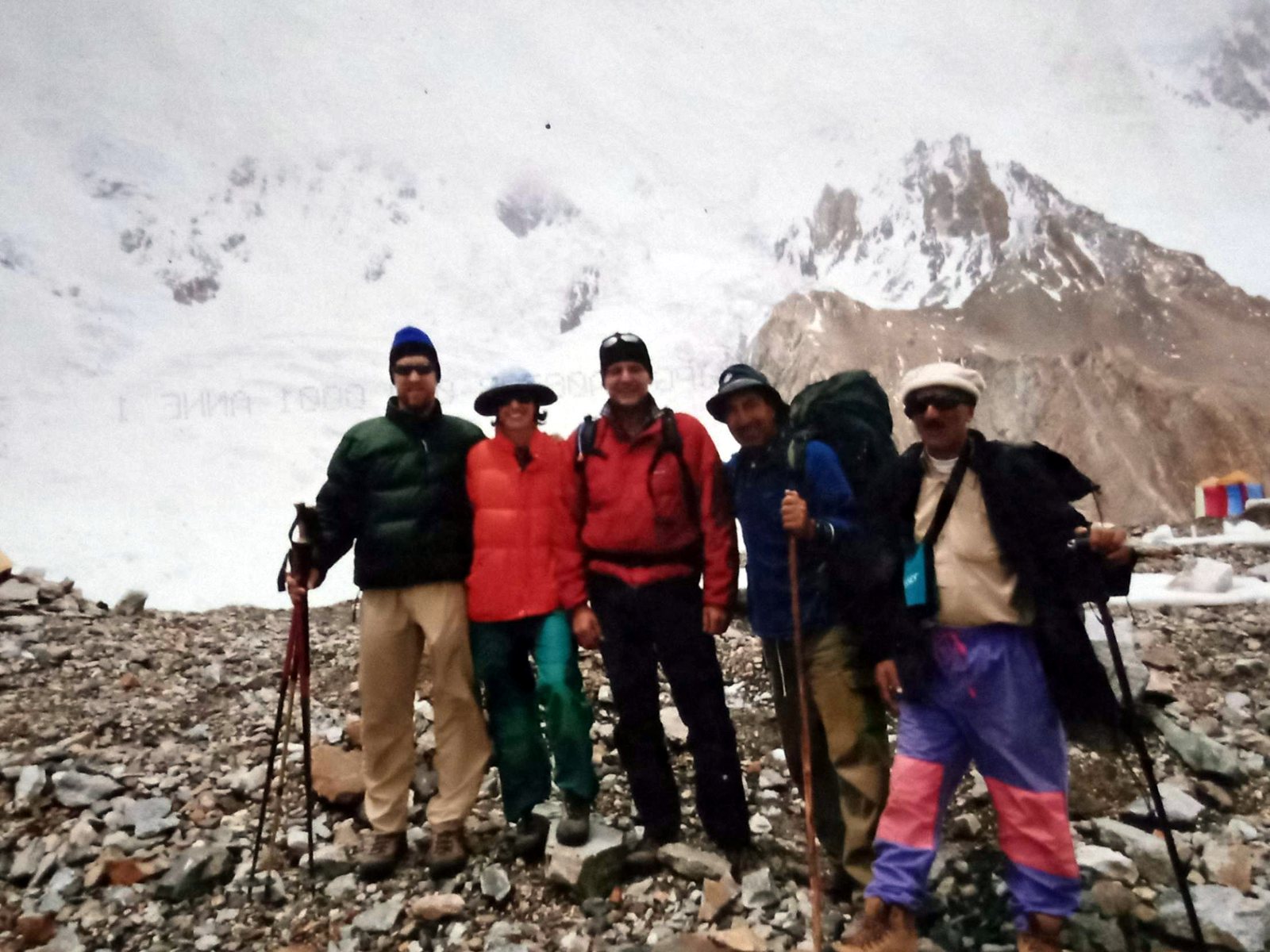
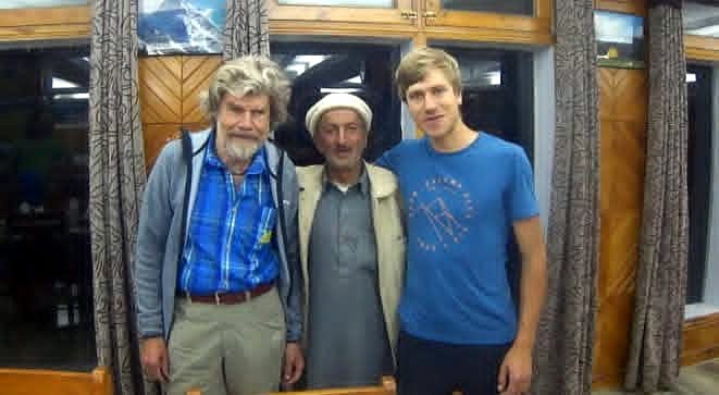
Rozi Ali and Reinhold Messner: from K2 in 1979 to Hushe in 2025
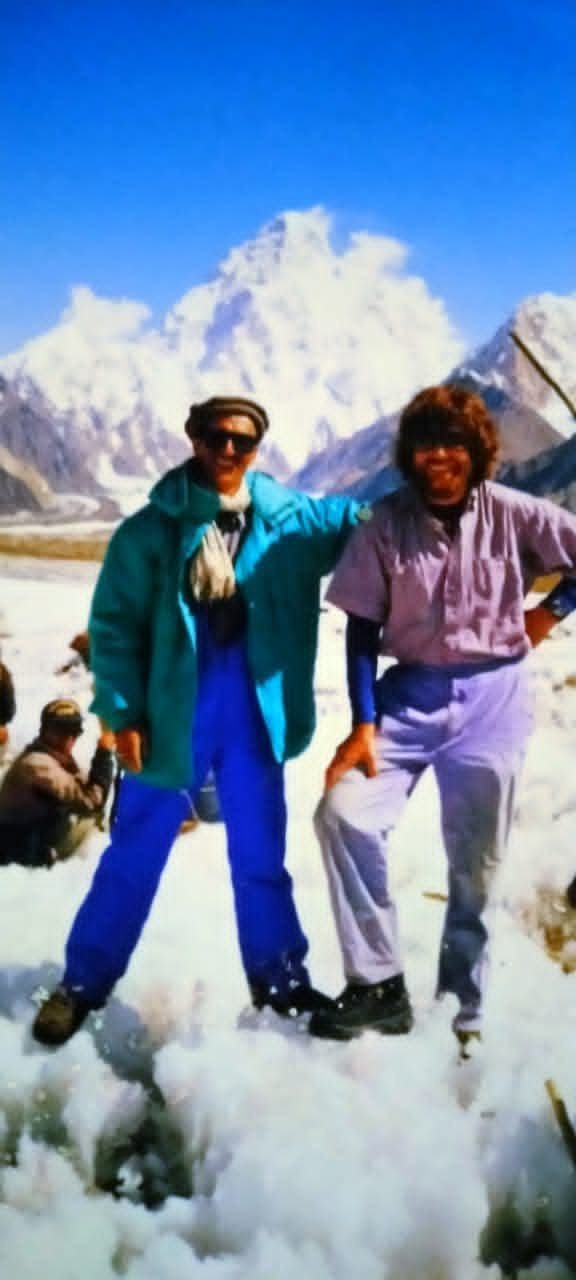
In 1979 Reinhold Messner led a small expedition to K2. Rozi Ali was part of the team that walked in through Askole and up the Baltoro Glacier, and Messner and Michl Dacher went on to reach the summit by the Abruzzi Spur. These photos come from that journey.
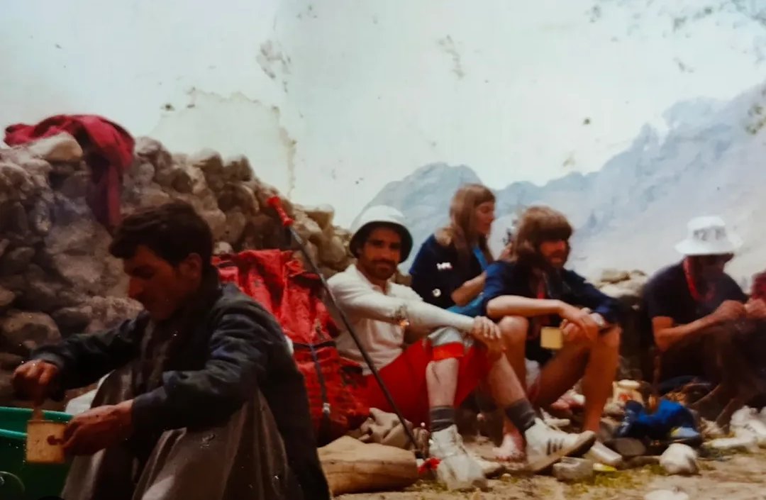
Forty-six years later, in 2025, Messner came back to Baltistan with his wife and visited Rozi Ali at his home. They sat together over the old expedition photos and talked about the climbs they shared. Few friendships in the Karakoram span that long, and it is the same mountain knowledge that guides every Discover Karakoram trip today.
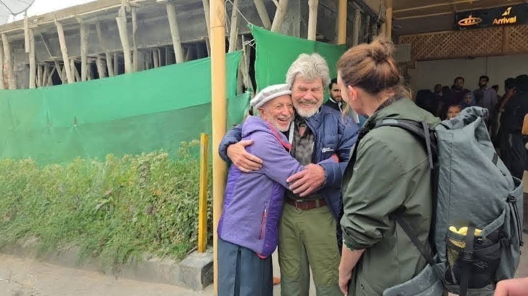
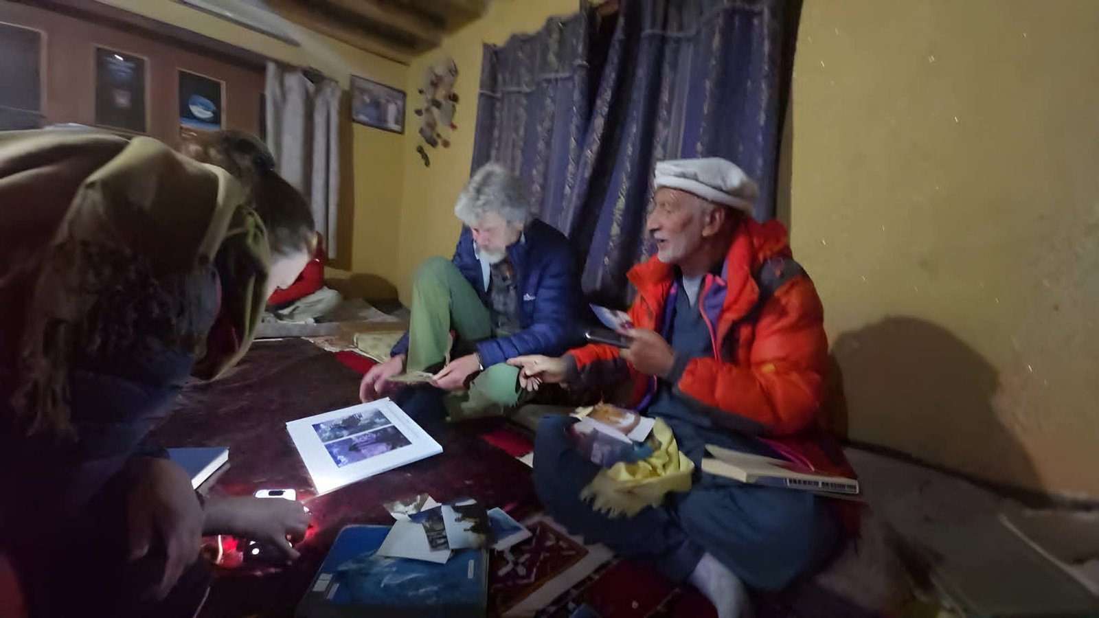
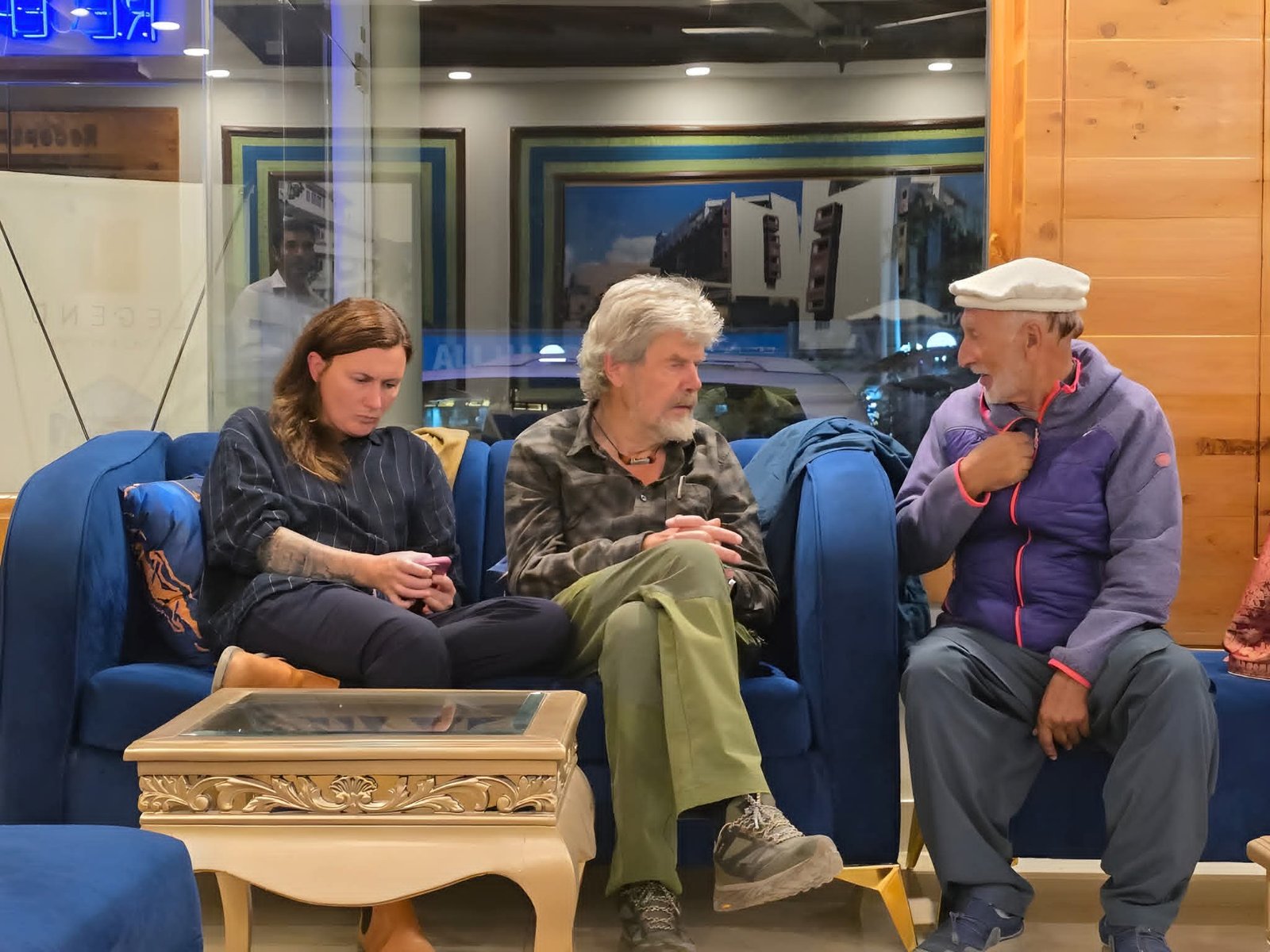
Read the stories ofthe 1988 Masherbrum II first ascent andthe 2023 Yernamandu Kangri first ascent.
Best time to visit the Karakoram Ranges
The best time for treks and climbs in the Karakoram is June to September, with July and August the most stable months for high treks such as K2 Base Camp and Gondogoro La. Culture tours are best in April for blossom and late October for autumn colours. Winter, December to March, is the season for snow leopards, ibex and ice climbing.
| Activity | Jan | Feb | Mar | Apr | May | Jun | Jul | Aug | Sep | Oct | Nov | Dec |
|---|---|---|---|---|---|---|---|---|---|---|---|---|
| High treks (K2 Base Camp, Gondogoro La) | ○ | ● | ● | ○ | ||||||||
| Valley treks (Barah Broq, K7, Masherbrum Base Camp) | ○ | ● | ● | ● | ● | ○ | ||||||
| Climbing 6,000 m to 8,000 m peaks | ○ | ● | ● | ○ | ||||||||
| Karakoram Highway and Khunjerab | ○ | ● | ● | ● | ● | ● | ○ | |||||
| Blossom and autumn culture tours | ● | ○ | ● | ● | ||||||||
| Snow leopard and ibex tracking | ● | ● | ○ | ○ | ||||||||
| Ice climbing in Hushe | ● | ● | ○ |
- High treks (K2 Base Camp, Gondogoro La)Best: Jul, AugPossible: Jun, Sep
- Valley treks (Barah Broq, K7, Masherbrum Base Camp)Best: Jun, Jul, Aug, SepPossible: May, Oct
- Climbing 6,000 m to 8,000 m peaksBest: Jul, AugPossible: Jun, Sep
- Karakoram Highway and KhunjerabBest: Jun, Jul, Aug, Sep, OctPossible: May, Nov
- Blossom and autumn culture toursBest: Apr, Oct, NovPossible: May
- Snow leopard and ibex trackingBest: Jan, FebPossible: Mar, Dec
- Ice climbing in HusheBest: Jan, FebPossible: Dec
● best months · ○ possible · blank not recommended. Based on our own season records from Hushe and Skardu.
Read our fullseason by season guide to the Karakoram.
Permits, access and safety
- Getting there: fly from Islamabad to Skardu or Gilgit (weather dependent), or drive the Karakoram Highway in about two days.
- Visa: most nationalities need a Pakistan visa, which can usually be applied for online.
- Trekking permits: treks in restricted zones, such as the Baltoro and K2 Base Camp, need a trekking permit arranged by a licensed operator. Many valley treks are in open zones that need no permit.
- Climbing permits: peaks above 6,500 m need a climbing permit and royalty from the Gilgit-Baltistan authorities; we arrange all of this.
- National park fees: Central Karakoram National Park and Khunjerab National Park charge entry fees.
- Insurance: you need cover for trekking or climbing at altitude, medical treatment and helicopter rescue.
- Altitude: gain height slowly, drink plenty of water and descend if you have symptoms of altitude sickness.
Treks and expeditions in the Karakoram
Whether you have one week or six, there is a way into the Karakoram for you: short treks with K2 views, glacier treks to famous Base Camps, first 6,000 m peaks, 7,000 m and 8,000 m expeditions, big wall climbs, culture tours on the Karakoram Highway and winter wildlife trips.
Find your Karakoram trip
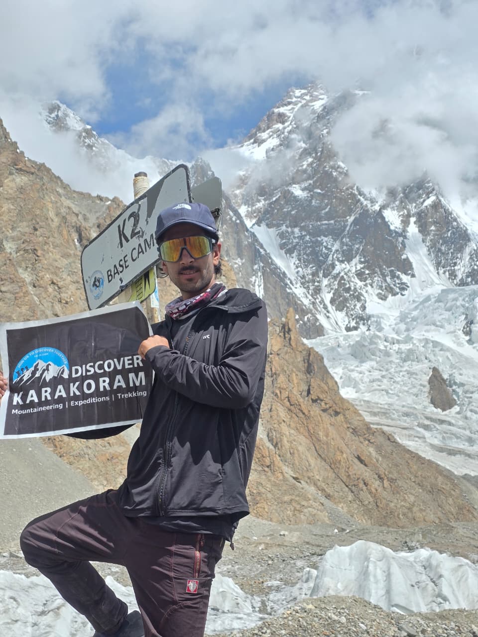
Karakoram Ranges FAQ
Where are the Karakoram Ranges?
The Karakoram Ranges lie in Pakistan, China and India, north of the Himalaya. Most of the range is in Gilgit-Baltistan, Pakistan, with its northern slopes in Xinjiang, its eastern end in Ladakh and its far north west tip in Afghanistan and Tajikistan.
Is the Karakoram part of the Himalayas?
No. The Karakoram is a separate range north of the Himalaya, divided from it by the Indus and Shyok rivers. The two ranges and the Hindu Kush meet near Jaglot in Gilgit-Baltistan.
What does Karakoram mean?
Karakoram is a Turkic name meaning black gravel. Traders first used it for the Karakoram Pass on the route between Ladakh and Yarkand.
How long is the Karakoram range?
The Karakoram is about 500 km long.
What is the highest peak in the Karakoram?
K2, at 8,611 m (28,251 ft), the second highest mountain on Earth.
How many 8,000 m peaks are in the Karakoram?
Four: K2 (8,611 m), Gasherbrum I (8,080 m), Broad Peak (8,051 m) and Gasherbrum II (8,035 m).
What is the longest glacier in the Karakoram?
The Siachen Glacier, about 76 km long, followed by the Biafo Glacier at about 63 km.
What is the Karakoram anomaly?
It is the observation that many glaciers in the central and western Karakoram have been stable or slightly growing in recent decades, while most mountain glaciers elsewhere are shrinking.
Can you see K2 without climbing it?
Yes. The K2 Base Camp trek reaches Concordia and K2 Base Camp in about 19 days from Islamabad, and the 7 day Barah Broq trek shows K2 from a summit of about 5,350 m near Khaplu.
When is the best time to visit the Karakoram?
June to September for treks and climbs, April and late October for culture tours, and December to March for snow leopards and ice climbing.
Do you need a permit to trek in the Karakoram?
Treks in restricted zones such as the Baltoro and K2 Base Camp need a trekking permit arranged by a licensed operator. Many valley treks are in open zones with no permit needed.
How long is the Karakoram Highway?
About 1,300 km from Hasan Abdal near Islamabad to Kashgar in China, with about 800 km in Pakistan. It crosses the Khunjerab Pass at 4,693 m.
What is the difference between the Karakoram Pass and the Khunjerab Pass?
The Karakoram Pass (5,540 m) is an old caravan pass in the eastern Karakoram that gave the range its name and is no longer a trade route. The Khunjerab Pass (4,693 m) carries the Karakoram Highway between Pakistan and China.
Plan your Karakoram journey with local experts
Discover Karakoram Treks and Tours is a government licensed operator (DTS Licence No. 2369), a member of the Alpine Club of Pakistan and PATO, based in Hushe and Skardu. Our founder Rozi Ali has worked in the Karakoram for about 40 years.Contact us or WhatsApp +92 355 5733499 to plan your trip.
Sources
- Wikipedia: Karakoram (length, countries, name, glaciers, passes)
- Wikipedia: List of highest mountains on Earth (peak heights and first ascents)
- Britannica: Karakoram Range
- Field notes from the Discover Karakoram team, Hushe and Skardu, seasons 2023 to 2026
Update log: 23 October 2026, first published; peak heights checked against Wikipedia.
